Showing posts with label maps. Show all posts

Tuesday, June 06, 2023

I'm...baaaacccckkk...

 It seems like it takes at least a day or so to recover even from a mini trip of 48 hrs.


The drive across the state was pretty nice aside from the intense heat. I had mapped a route that would take me to Paradise Springs Natural Area. I planned on a picnic out of the back of my 'Ru with Charlie.

When we pulled up and parked in the small lot under a tree there was no one else around. I shared some PB&J with Charlie and he had a big drink of water.


I grabbed my back pack and thought we'd head into the little trail to see the spring building.

Another vehicle pulled up and two older guys stepped out into the heat. They asked if they could pet Charlie. Charlie loved the attention. When we walked around the corner from the parking lot there was a huge red sign:

NO PETS!

I was crushed. I stood there. It was too hot to leave Charlie in the car. The guys looked at me and the one said: We won't say a thing. I doubt he will harm anything.

I tucked Charlie under my arm and headed down a paved trail. The last time I'd been to Paradise Springs, the trails were dirt. The area had suffered quite a bit of neglect. After the 2018 record floods groups got together and donated monies to fix this little beautiful place. New trails were laid down and paved. The pond was cleaned and benches along with a nice little deck for viewing was made.

The improvements were beautiful. The building was the same, but the area was much cleaner. 

The Spring Building from across the pond.
The water smelled bad because
of the lack of rain and fresh 
water.


Inside the building looking out through 
the windows across the pond
back towards where
I had been standing.


The two older guys looking
for turtles.
One fella told me that he
'rescued' turtles by taking them off
the road and bringing them to 
this pond.
I saw no turtles and they didn't either.


There were quite a few nice benches along the paths with donor's names on them. I took a few shots with my IR camera and scurried back to the parking lot so as not to get in trouble. Charlie stayed tucked under my arm.

No selfie with Charlie to add to our collection of doggie photos. I was disappointed, but understood that sometimes people who don't make their pets behave ruin it for those that do.

I sat in the back of the 'Ru with my dog and we had some water while I plotted our next stop. Beula's Bog. 

In truth, it sounded way too hot and muggy to go to a Bog, but we'd head that way and check it out.

I followed the directions...until...

the connection between my smarty phone and my car stopped. I couldn't stop on the narrow back road safely to try and figure it out. So I just 'winged' it. I drove on one curvy road and to another unmarked black top and eventually came out in a town. I pulled into a parking lot and disconnected everything and restarted the phone.

I really regret not having a good ol' paper map in my car. I must have cleaned out the 'Ru and tossed it. 

By the time everything was set, I decided that it was too hot and nasty to go explore a bog with Charlie. I set my sights on Petrified Springs Park and decided to go there until it would be time to drop in on the 'kids'.

I was looking forward to cooler weather near Lake Michigan.


And so it went...

Wednesday, January 26, 2022

Chilled out


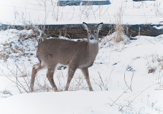
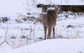
Our nightly visitors keep appearing just behind the outhouse and hear the north pasture. When I shot these photos the camera sensed everything as 'blue' and I guess the snow would reflect that just after sunset. I shot these through two panes of glass and set the camera on Auto to see what would happen.

The ISO went to 6400 and the photos are a bit grainy, but dang! It wasn't so bad! Cameras sure have come a long way. I shot these with my cheapo used long lens and still, I am impressed. 
These are the same fawns as I did the artsy fartsie stuff too but on a different evening.

The deer are coming to our weedy area behind the outhouse because the meadows and the forest are fairly deep in snow. There is easier pickins right here. As browsers, they don't stay long. But right now just as the sun sets they appear.

I call out to hubby to let him know the visitors are descending from the woods above and he turns off whatever he is watching and stands at the back door. He counts them out to me and provides a narrative while I do whatever I am busy with in the kitchen.

With wind chills as nasty as they are and a busy schedule with Video interviews, I have decided to give up even thinking of going out for anything other than providing warm water to those who don't have a heated water tank, and feeding those birds.

I went to clean up my spare room and sort some things and ended up messing around with ... well...
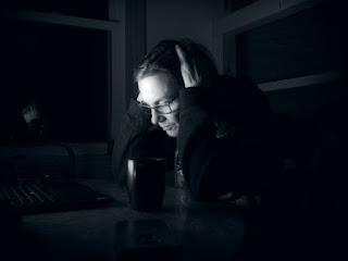
Guess who's coming for dinner?


Remember this song? 

Ten in Bed

there were ten in bed 
and the little one said
roll over
so they all rolled over 
and one fell out

there were nine in bed
and the little one said...


I have no idea why that song came to my head when I was gathering all these tiny Teddy Bears together...but it did.

I needed to distract my mind with something else after organizing the toys and art supplies.

So I spread out my old maps.


I'm thinking of a warmer day when I can get back on the trails. 

And I got this in the mail, very appropriate.


-17 F tonight with gusting south winds?

Saturday is the new date for the kids and I to hit the ice caves in the morning. After this week, I'd feel like anything above zero is warm and any time outside with others would be welcome.

Adulting is
sometimes tough...


Saturday, September 04, 2021

The Hay Valley Adventure

Charlie and I took off to a trail I hadn't been on since 1996. Hay Valley Trail. It can be a very long trail, but if one watches for another trail called the Washout Trail and takes that, a loop can be made back to the parking area.

I also knew that skeeters were going to be an issue. 


Here we are at the trail head with a little pep talk from me to my Trail Leader. I've been wearing this net and have gotten so used to it that I forgot I had it on. I tried drinking from my water bottle with it on! That was hilarious. It may look stupid, but it is a life saver when the bugs are out!

I took my pocket camera and brought my Infrared camera with with 2 funky colored and cheap filters along. I chose the bright yellow and the blue.

I've seen others experiment with filters like these and yes, they are cheap and generally not very useful.

But, I really enjoyed experimenting.
This was the start of the trail with the Yellow filter on.
I took this same shot with my little pocket camera and it really did not pick up the nuances of the sunlight and path. It was green with dark areas and overly bright areas. This is one of the places that Infrared does shine through.


Off the trail I was able to spot a lot of small orange mushrooms. In fact if the bugs were NOT so bad I would have really had a lot of fun searching. But I didn't know how long the trail would take us to do, so I grabbed some shots with the little pocket camera and kept moving.


We found the foundation that was on the side of the trail. I do know the history behind the foundation. An old gent told me that this was part of the farm his parents had been removed from.
He'd buried his toys in a box not far from there and had always hoped to go back and retrieve them. This had been part of their Ice house where they kept things cold before electricity and refrigeration.


Foundation shots with Charlie - inspecting photographed in Infrared with the Yellow Filter on. 


Just when I thought Charlie and I had missed Trail marker 10, we found it.


IF you are on foot, YOU do not want to take the wrong trail in this section, well, not if you are planning a loop. The Hay Valley Trail or Bailout Trail will take a hiker far from the trail head at Camp U. 
Bringing a physical paper map IS recommended, do not depend on your cell phone for directions. Many areas have no coverage. 

I thought of someone who sees faces in trees when I saw this old oak. He looks confused about the trail signs too.


The tree on the left is dead, however if one looks down the valley past this tree, one can see the Kickapoo River. 
At this point the trail has made so many switchbacks and turns, a person can be completely disoriented. One needs to keep in mind that the trail stays on the west side of the river and in its twisted up and down way, it runs basically north and south.


This is on the Washout Trail where Charlie and I had a small break for eats and water. I also put the blue filter on for the rest of the hike. 


The Washout Trail is a hiker only trail. Aptly named as there are places that do wash out and water runs off down the middle of the trail. It is scenic and enters a majestic maple forest which stopped me in my tracks. 
There was no way that I could even attempt to catch the incredible greens and dappled sunlight.

I tried and failed with the pocket camera. However. I can really see hiking to here when the maples turn and bath myself in the golden Autumn light and leaves!


I knew from the map that the trail would connect back up to the Hay Valley Trail in the valley and I'd cross the new bridge back to campsite U.
When I approached the valley floor there was a trail split.
One went left and uphill, the other went down and around a huge open field and into the woods.

I swatted skeeters and opened the map. No such split was noted on the map. There was no markers and both trails looked used. I walked around the field trail for a few minutes and decided this one probably could be it, but it felt wrong. I could hear vehicles on Hay Valley road where I had parked.

I took a reading with the map and the compass and decided to take the other trail. Halfway through that trail I came across trees that had blown down and had not been cut up. At that point I realized I was not on the proper path but probably on a trail used by the reserve workers when they did work on other areas of the ridge above me. 
I muttered a word or two to Charlie who was now dragging his butt. I picked him up and went on. 
I ended up on the edge of a marsh that connected to the Washout Trial. My choice of going up and then down to the marsh worked out better. Less water to walk through and it was shadier.


We made it back to the car and then walked to bridge 6 and admired the quiet Kickapoo River. Just last week it had been raging over the road where I stood.
One last shot with the blue filter and the IR camera and we headed back for snacks in the back of the 'Ru.


We came, we adventured, we survived. And the skeeters never carried us off.
I will do this one again in the fall and in the winter. 
I doubt this trail is often used by hikers. Not because it is really difficult, but that it is a bit off the beaten track.

That makes it a Great Trail in my book.


Friday, March 12, 2021

Know where you are.

There was a story this week about how a woman had to be rescued at the Kickapoo Valley Reserve. She had gotten lost. 

Woman lost on Kickapoo Valley Reserve. 

She was found safely around midnight. The sheriff department used a drone to find her heat image that night and she was 'rescued' unharmed. 

I am not going to make fun of her experience. A good friend of mine last spring called me on her cell phone as she and her family had taken a wrong turn 'somewhere' on the Reserve and she felt lost. That worked out as her husband [ex marine] took them to a spot and went to get the vehicle on his own.

Here is look at the map.

and a closer view:
This area in close up, is probably THE most confusing part of the KVR.
I carry a paper map while hiking and I have my map marked up with mileage of each section of trail along with notations about tricky trail junctions.


Here is a satellite map of the area not all of it, but just enough to give you and idea of the contours, hills, and valleys.


I have many friends whose biggest fear is getting turned around in the KVR. I have ridden mules on the Reserve before it was the Reserve. Now I spend my time carefully plotting hikes to show my pal.

On my own two feet I have done all but 4 miles of the 50 miles of trails. There is some wonderful logic to use here. Hike with someone you know. If not, have a paper map AND a compass. Some junctions are tricky and it is easy to go west when you intend to go east if it is heavily overcast.
Don't leave the trail if you don't understand the lay of the land. However, walking the trail will eventually take you to a road. Listen for traffic. If you are quiet you can hear in which direction roads are.

Bill and I took a wrong turn last winter. Too much talking and not enough paying attention. We backtracked and were fine. So having Bill with me asking questions was my downfall. We didn't get lost but it sure was embarrassing to me.

I recently spoke with another friend of mine and she had asked if I'd show them around to the ice cave trails as she'd tried to figure it out but was afraid of getting lost with her kids. 
I am more than happy to, the KVR is no longer the mystery it used to be.

One more satellite view. The circled area I hike and live in. I've spent from 1996 to present walking/riding this area. The very first time I went on my own, I took my mule so in case I got turned around, he'd take me back home. Now I hike it daily up and down the hills and through the valleys. 

When I first moved here, I could not figure out my directions. 

I am hesitant to try places that I don't know. However I would love to get to know Governor Dodge State Park and Wyalusing much better. Unfortunately they are an hour drive one way. Too far for a quick hike. 

We are lucky in our county to also have Sidie Hollow, Esofea, Duck Egg, and Jersey Valley County Parks to hike/ride equine/bike/camp in.
Okay. I got way off track.

Be prepared. I always have a backpack with food, water, map, compass, emergency blanket--the space kind. A Firestarter, and a lighter. Of course a little first aid kit too. 

Last funny thought. 25 years ago two ladies came into the Chiropractor's office where I worked and told me a story how they'd gotten sort of lost on the Reserve. No cell phones at that time. The one lady said they'd been hunting morels and got off the beaten path. It got dark so she built a campfire and waited until morning when she could get her bearings and walk out.

That story stuck with me. Those women were totally calm about their experience. 

One of the signs at the trail heads at KVR is to notify hikers to not depend on their cell phones as the reception is spotty at best in the deep valleys.

I am very happy to learn that our Sheriff Department is able to launch a search with a drone that can read heat images. 

I hope to hike on Saturday on one of the less popular trails. This week has been full of appointments. I'm off to get my eyes examined in a bit.
Rich said I should have my "head" examined.

This photo is from Tuesday...our first crocuses!
And now to the weather...Sunday
snow/sleet/rain and yuck!
Gotta love March!


Friday, May 08, 2020

Distance Hiking?

I know there is a huge issue with public lands, state parks, and social distancing. We happen to live in an area where crowding is not an issue, especially during the weekdays.
Going hiking together with friends can present with problems...

However my good friend from CrossFit [and a neighbor who lives about a mile away], and I have figured out something that has given us both as very active 60+ people ... how to hike together and apart!

We have set up a goal to hike together/apart once a week. Four weeks ago Bill was feeling rather down and out. We discussed this on the first 'hike' we did with Charlie and decided that we were both having a hard time dealing with Social Isolation and the huge disruption in our daily routines of being able to work out and hang out at the gym.

Bill and I have decided to limit our exposures [hiking] to our two households. Our county is starting to show up with some serious cases so we are practicing mental and physical support for each other.
We've found that this once a week event help us deal with everything else in our lives.
Interestingly enough, while hiking with Bill, I don't feel compelled to complain or even gossip!
Bill is recently retired and is all about exploring this new natural world that he lives in.

Our hikes our with Charlie and for the sole purpose of discovering plants, new trails, ... and easy trails that he can find to take his wife on.

Getting partially lost on new trails seems to be a thing we do.


Here is Charlie tied to a tree while I climbed out on an out cropping of rocks.


It looks more dangerous than it was.

Having another person along is so much safer. Rich doesn't mind as I normally come back with such a calm laid back attitude that it makes our life in Isolation much nicer.


Our focus is Charlie. The little tiny dog with 3 inch front legs who trots along the trail and leads the way.


Well, not entirely. Exploring the spring flowers was something that stopped us both in our tracks.

Bill said it best. He stood amazed and said, "I don't think I've ever in my life seen as many Trillium as I see in this spot. In fact I think this is more Trillium than I've ever seen in my entire life!"

We both just stood there admiring the forest of thousands of trillium interspersed with Spring Beauties and Bellwort.


I mean we literally just stood and took it all in!

I found some of the old horse/mule trails to get on top of the rocks. At one time we used to actually ride to the top of these places.


I got Bill to ham it up for me.

He is not at the very edge. I just angled it so it appears that way.


When we reached the 'Loop Lookout' Trail we realized that we didn't have enough time to actually hike the loop and get back home before our spouses would wonder if we fell off the earth.

I sat on the trail and pulled out the map. I noted that the trail we had been following skirted a ridge and a crop field. I showed Bill that if we simply crossed the field we'd cut shorten our time hiking back.

Let me say that I am so grateful for all of the time I've spent learning about maps and the way this land is formed.
We walked around the field and were only 15 minutes from where we had parked.

Next trip out, we'll take the short cut and proceed to the loop we intended to do in the first place.
Now that we know about the short cut, we can explore more rock out crops.

Here we are failing at keeping 6 feet apart.


I set up my little red camera on the log as we stopped to have an apple and share some bits with our Trail Boss, Charlie.

Our Distance Hiking/Safe Socializing is working pretty well for us.

I showed Rich the photos and he quipped, "Finally! You have found someone your own age to play with!"

I am grateful to have a friend like this who is genuine and who likes hiking and exploring as well as I do.


And...
now
we wait to see what next week brings.

"I want to be improbable
beautiful and afraid
of nothing,
as though I had wings"
~~ Mary Oliver

Wednesday, February 05, 2020

Wrong Way Me


A friend from CrossFit asked if I could show him some trails to hike on. He is looking for some nice hiking trails to take his wife on. I said sure!
I've been asked by other friends at CF and they sort of have interest but then sort of don't pursue the request. I won't push anyone into hiking with me at all. It has to be their choice.

Bill and I set a date and time and went for it.

The above shot is one from Bill's cell phone as we started out the hike. The Reserve has many trails and some are very nice wide trails that are shared in the winter with snowmobile trails. Other trails over more sensitive areas are only for hikers. Many trails are multi use which really makes this a great place for everyone.
A person can choose to take tough trails or easy trails.

With the warm temperatures this past weekend, the snow melt was significant. It was obvious that the trails had turned to mushy wet footprints that with Monday's cold weather had turned the trails into icy rugged ankle twisters. 
I suggested we hike with Yak Traks and Bill agreed.  There was an ice crust on the remaining snow on the sides of the trail, but walking in that was harder than negotiating the icy footprints.

I'd taken a less traveled route and by mistake followed the snow mobile trail in the wrong direction I wanted to go in...but the footing was so much nicer! 


Hikers and snowmobiles share these trails and it was easier to walk on.

We went around a huge rock formation and Bill pointed it out. I said something like not recalling that on my last hike.

Then at the bottom of a long hill I stopped in my tracks. I'd taken a wrong turn. At marker 3, I should have gone left instead of right. Bill laughed and we made the executive decision to just double back as we had plenty of time.


That's Bill.
It didn't matter much to him that we were back tracking at all. He said the scenery was stunning and I had to agree with him.

IF I had used viewed my position on Google Maps with the Satellite choice, I would have easily seen that I was very close to where I'd parked just last week to hike to the ice caves.
My bad.
We could have walked out the the county road and hiked along the nice flat road back to where we had parked.

Both Bill and I decided we'd come back this spring and hike to the formation of interesting rocks we'd seen.
I was embarrassed that I'd taken the wrong turn and felt worse than ever about it after I realized that I could have made our hike back a bit easier.
Bill was such a good sport.

The end result was that we walked the less icy trails...AND Bill asked if we could hike again next week.
So I guess I didn't put him off after all.


I think Bill is getting his own map of KVR and he said next time he was bringing his compass.
I usually have one attached to my back pack.

I wonder where I left it.
Anyway two heads are better than one I think.