Showing posts with label ice formations. Show all posts

Thursday, January 22, 2026

Take a hike

~~~

After a few days of staying indoors except for chores ---> which I did with my wonderful get up of goggles, mask, insulated coveralls, and insulted boots...and pasture checks in said sub freezing temps....

I decided that 18 F [-7.77 in C] was a really warm day and a good one to go exploring. Even Charlie wasn't going to let me outside without his permission.

He does have the bossy characteristics of a Dachshund when he really wants something.

Off we went. As soon as we hit the road, it started snowing. Well, I do have a Subaru and it is meant to deal with my steep driveway and poor weather, so we just continued on. 

We had ice to explore [the good kind that Mother Nature makes].


We went looking for some familiar ice formations.

I took my Infrared Camera so that I could photo the ice and it would show up better against the snowy background.

For anyone interested, this was shot in IR Chrome. Chrome was used during WWII to differentiate between camouflage and real foliage. The filter was developed to make anything with chlorophyll to show up as red or hot pink. Any 'fake' camo would show up easily.

The Infrared filters are for more creative photography. I like to use it in the winter to separate the ice formations from the snow surrounding them.


Here is the view on the last part of the trail through Hemlock trees.


Below is a glimpse of the Kickapoo River which still has a bit of open water showing. I imagine by Saturday or Sunday that will be all ice. However, the river still flows underneath. 


I've walked this trail more times than I can count. Each time I go, I seem to discover something different.


What I discovered this time is that the 'pines' I was walking through are actually Hemlocks. Frankly, I never thought of what kind of pine tree it might be until I was fascinated by the snow falling on the little needles and then the tiny pine cones that reminded me of Tamarack trees.


Chippy accompanied us, however, Charlie wouldn't sit with him at the end of the trail. He was more interested in the coyote tracks in the snow.


Still, the scene was quite beautiful with the falling snow making everything look soft.


The roads were snow covered by the time I drove home. 


Friday, January 16, 2026

Wyalusing ice and Chippy


Mr. McCool and I went adventuring again today. It seems that I feel quite driven this winter to keep busy and keep at it. [I added the cool sunglasses with AI.]

I am thinking of how I can get out each day and plan an adventurous hike. I feel driven to go find ice formations. The house is too quiet. The logged forest that used to bring me peace and solitude has been destroyed [my words].


Thursday morning broke with sunny skies and temps that were to get up to 20 F. The WNW winds were to be light.

Perfect.
I put my sidekick in his car seat and we headed out. 

I wanted to check out Wyalusing's ice caves. I knew they wouldn't be spectacular after all the rain and warm temps we had, but I don't like to compete with the crowds that would come on the weekends. Week days seem perfect for exploring State Park trails.


This formation is called the painted cave because of all the colors in the rocks. I couldn't believe how brilliant the pink and the yellowish orange colors were on this visit.


We did go down inside of it. The size of this formation is tremendous, larger than any rock shelter I've ever been in before. It looked like someone had dumped blue food coloring on the ice formation itself. 
[Vandals!!!!]


We took the well traveled trail to the second cave. I could hear the water running even before I got there.

This photo doesn't give the viewer any idea just how large this formation is. 


Since getting in close felt a bit iffy, I decided to stay in the 'safe' zone and shoot what I could.

I was entranced by the portions of ice that had dropped to the bottom of the rock formation and had new and interesting patterns of ice forming from the melting ice above along with the spring water that flowed down and froze.

For perspective, these ice formations on the ground are taller than I am.


It never ceases to amaze me, what art Mother Nature creates.

I could have spent hours here, but decided to move on. After all, Charlie is quite the task master when he believes we should move on.


For this trip, we brought a mascot.

Chippy. He is quiet. He travels well in a backpack and requires very little food.


Plus....

Charlie didn't try to tear him apart. 


We have some more ice formations to check out on Friday if everything goes to plan. 

Life in the .... frozen lane?


Saturday, December 06, 2025

The day was sucky until....

 But it ended up being a good one.

I meet the neatest folks while hiking. Yesterday I met a very handsome young man named Jesse. Hmm. I think I better start at the beginning.

The morning was cold bright and clear as a bell. My mule dragons were snoozing in the morning sun before I did chores.


I'd forgotten to sign up for class but went anyway and forgot my gym shoes in the car. I should have seen that as a sign, but I dealt with it.

At least I'd already packed my backpack with water, snacks, and all the gear I normally take with me for safety. I'd planned on going Ice Hunting when I got home from town.

The clouds had moved in so it was another one of those very overcast days with the promise of snow in the evening hours.

I decided to bring my Infrared camera anyway. I could take shots of the first ice cave with the startling range of colors that ice has with IR.

When I got to the first site, I was so happy to see ice forming. The previous blog had a photo of me in the upper right 'cave' with Charlie 2 years ago.

[The ice shows up blue because of the way the light waves with IR reflects from it.]


I went to grab my cell phone to take a wide angle shot before climbing down to another spot for a shot with my regular camera.

My cell phone was not in the inside zipped pocket. I stopped in my tracks. WT Heck??? I cursed under my breath and I'd better backtrack and hope the heck I can find it. How the zipped pocket came undone was a mystery to me.
Since I was the first human to leave tracks, backtracking wasn't too hard. After climbing down the steep hill, I found the phone sticking up out of the snow.
Crap. Was it still working? 
Fortunately it fell so that the ports were not buried in snow. I wiped it off and stuck it in my zip pocket once more.

Oddly enough, I checked the pocket after about 50 feet more of hiking and found the zipper coming undone. Mystery solved. I moved the phone to a zip pocket on my pants. Phooey. 

I decided to skip cave site number 2 and head out to the one area of Weister Creek that never disappoints.
We followed a deer trail with Charlie charging ahead.
I wanted to see how the ice was developing on the creek itself. Even the faster flowing areas were freezing over. 


We moved on down to the area where the mini bluffs were. Each year this spot produces amazingly beautiful ice formations as water drips from the rocks to the creek.

These are two samples of shots in Infrared. The blue tinted one with the 'orange ice' is pretty much what is seen in camera.


This second one is with channel swapping. The ice and waters are blue and the foliage is pinkish. I simply reversed the colors for a different effect.
Oddly enough, Charlie knows exactly where we are headed and the route we take. He is waiting patiently for me to catch up to him.


He is also learned NOT to go onto the ice ever. He is actually a pretty wise dog.

I finally pulled my regular camera out of my backpack. [My backpack has a rubber bottom so it doesn't get wet from the snow.]

These spots never cease to wow me. This is basically an off trail adventure which is not easy to get to. Years ago there was maintenance on this 'winter trail' for paid tours in February. In the past few years, the marking of the trail and clearing of trail debris has stopped.

I don't know if it is the new management that did it or lack of workers and funds. 


I climbed over the bluff with the ice on it. There used to be a very nice old trail that we rode our mules on in the 1990's above the ice. I was surprised and dismayed to see that the storms through this year had downed so many trees. 
It was quite the effort, but we rerouted and ended up at another ice formation.


By mid February the ice here is so thick, one cannot see the rocks behind it. As the ice ages and develops more, it takes on the colors of minerals from the seepage.

Here is a shot from 5 years ago in February:


A closer look at the rocks in the creek near where I was standing. The water here rushes by and splashes onto the rocks creating little icicles.


It started to snow so I decided I'd take a quick walk back to the second site and take a peak at those ice caves. 

The climb up the hill [zig zagging because it is so steep] was 135 feet. I can say that I did not do it in a rush. By the time I got to where I could peer down into the rock formations, it had started snowing heavily.
Instead of investigating them, I thought I'd stay up on the pine ridge and just walk above the ice caves and down back towards the parking lot.

This is looking down the bluff at Weister Creek.


Eventually I came to a 'blow down' that was immense. The pine forest had been decimated. The trunks and tops were blasted in every which direction and there was no way I was climbing through it.


I decided to follow a deer trail up and around it and I connected with the West Ridge Trail. I know that means nothing to the readers here, but that meant I had a nice wide cleared trail back to the car.


We got to the car and I placed Charlie in his car seat. I was feeding him a snack and a drink of water when the Kickapoo Valley Reserve Police truck pulled up. 
What do you do when you see a 'cop' car? First thing I think of is 'Sh-t, what did I do now?'

A very tall and handsome young man stepped out and walked over smiling. "On your way out or on you way in?" He asked.
I answered and stuck my hand out to introduce myself.

His name was Jesse. When he stepped up to shake my hand I realized how short I was. If I stared straight ahead I would be looking at the handcuffs on his vest.
Ahhhh. Dark haired and handsome. What I wouldn't have given to be 30 or 40 years younger!

We chatted a while and then he gave me his card. I will say this, he is out there talking to people on the Reserve and presenting a friendly officer vibe.

Damn. So good looking too.

I waved at the snow and said that I'd better get home. 

I sighed when I got in the 'Ru to drive home. The day was kind of sucky, but it sure improved in the parking area!


Monday, January 13, 2025

Another spot I've followed ....

...through the years.

I went hiking on PeeWee's. The large tract of land next 'door' on Saturday. I wanted to check out one of the first ice formations I discovered.

The hike to there is done through two valleys and a ridge and across a large field that used to be pasture for cattle. It is now cropland that is rented out.

The hike to this spot is 1.5 miles. To get an idea of how remote this spot is...
well there are no houses or roads anywhere nearby or within sight. 

The guys that inherited this land call the area below this dry run... The Lost Valley. 
The valley is very remote. It is steep and narrow. More on that in another post.

This is another favorite spot of mine. It starts at the top of the ridge and drops about 150 or so feet down into the Lost Valley.


I've followed this spot over the years ever since I've discovered it. 

Some years this part of the dry run gets an ice sheet over the opening of the rock shelter. Racoons, love to use the 'cave' as shelter in the winter.

This black and white shot is from 2019 when I was brave enough to take a rope and climb down into the gully.


Close up to the jaws of ice...


2011 another time I climbed down into the gully. I couldn't climb out of the dry run so I had to scramble over boulders and ice to follow the dry run to where it emptied into the stream below.
[The reason I now take a rope if I am going over the side.]


And when spring arrives...the ice loses its beauty.

I shot this shot last year leaning against the same tree as I did for the second photo.


This next shot was taken in November of 2001.

I climbed up the dry run from the creek in the valley wondering where it went. I had a Pentax K1000 with a broken light meter but I was able to guess at the exposure.


This shot may have been the very beginning of my love for Ice Caves, Falls, and Ice Formations.

If we get moisture in the form of snow and rain, this may develop into a more spectacular ice formation by late February or early March. 

The hike took me to the west side of this ridge and a newer ice falls. During the huge and devastating flash floods of 2016 and 2018, the small dry run turned into a huge ravine.

To my utter amazement and delight, this too had ice formations. I'll have to check out a safe way to get down into the area, but color me happy to find more ice.


The edges of this dry run in the spring have the most amazing spring flowers. I also visit this area in the spring to see all the Hepatica, Trillium, Skunk Cabbage, Spring Beauties, and more.


It was a long and satisfying hike. The ice falls/caves are doing well but need more moisture!

Monday, February 13, 2023

Drifting in the Driftless

 I thought it was cool to come up with that: Drifting in the Driftless.

Because that is exactly what we did together. I had a goal in mind, but I abandoned that goal and just decided to drift back and forth like the tiny stream that meandered through this narrow valley. 

The stream is not indicated on the map so it must come from various springs along the way. The valley is no more than 50 yards wide at its widest spot. The north facing hillside is steep with many 'dry' runs and rock shelters.
The south facing side is nothing but bluffs dotted with caves that I did not explore [this time].

Charlie and I followed the valley from the west end to the east end where it ended at the new highway that was built in the 1970's. 

Photo of the Kickapoo River
taken with the Infrared Camera.


The ice 'slide' in IR.


Rock Shelter with ice, IR.


I made a series of very short video clips and stuck them together to form a little view of what it was like. The video of course doesn't do it justice but perhaps one can get the sense of just how narrow and secluded this area was. 

I'm keeping the location to myself as I am pretty sure there are some rare plant species that thrive in this micro climate that is so unusual. 


So in the first part of the video you will see a familiar spot of the Kickapoo River. It was frozen over but the grinding noise was the ice moving and trying to make passage through the river. It unnerved Charlie enough so he started to whine.

The rest is with no sound because I don't think anyone would enjoy listening to the mic noises.

The video is 1:44 seconds. To see and understand just how narrow and wild looking this place was...I had to do it as clips.

Hope it is worth your time.


I was going to go back today but needed and eyeball rest. I'll be going back on Wednesday to visit the hogback above the caves. At least that is the plan.

Happy Drifting

Peregrinating

and Maundering about....


Tuesday, January 24, 2023

The Other side...

Last week I hiked along the east side of the river bluffs in a section of the Kickapoo Valley Reserve. 

View of last week's hike from the other side 
of the river.


I wanted to see just how far down the river I could get before I ran out of shoreline. Charlie and I made it about 3/4 of a mile and it was there that I noticed the large chunk of bluff that had broken away from the original bluff.

Now this could have happened a thousand years ago or whenever. I'm not a geologist, so I haven't a clue.
I wanted to compare it to the term 'calving' like when a large chunk of ice comes off a glacier.
I decided to walk along the western bank which has no bluffs, however that is where all the logs, trees, and debris from floods end up. 
It is a definite maze of downed trees, logs, roots, and weeds.

I didn't wear snowshoes so I had to fight the deep snow. Wearing the snowshoes would have made the climbing roots and logs much more complicated. 

I saw coyote tracks, I saw a beaver in the partially frozen pond to the south, but what really surprised me were some odd tracks on top of the snow.
It looked like something had been sliding in and out of the river.


It finally dawned on me when I saw a hole in the bank with tracks in and out, that perhaps the river had otters?
Oh Boy!
I studied the terrain directly across from the 'den' and thought it would be fun to come back and sit quietly on the bank or bluff above the supposed den and watch.
I've never seen a wild otter.

I did a LOT of climbing over banks and logs. Here is a photo of my leg in the side of an icy bank. [No, I would not have ended up in the river if I'd fallen! I was at least 10 feet from the water. I play it safe when alone.]


Recall the hole in the rock I am searching for? Well last week I stopped at the orange arrow as there was no shore left to walk on.


Another view of the flat rock.


There is the hole, the tunnel, the cave...whatever you want to call it. 


Getting there by land is going to involve some research.


The area above the rock bluffs and the river can be hiked but it would be an experience for sure. 

Below is a topo map. The orange arrow points to the rock with a hole in it and on each side of that spot, the river is right up against the bluff.

The black triangles are camping spots and the dotted lines are trails. The solid black lines are roads. 
I may have figured out a way from one of the campsites or come in from the road through the brush and just find my way.


If nothing else, I'll first explore it coming in from the road which would involve less climbing and be able to look out from the top of those bluffs.

The trail next to the river [blue line] is about 160 feet below the top of the bluffs according to their calculations.

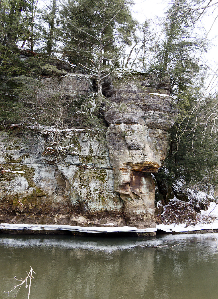
This is near that bluff and some straight on shots of the rock formations and ice.
I doubt too many folks see this as it is a chore to get too, but not too bad in the winter time.


My hike ended up being about 4 miles. Half of it was rough hiking and half was on trails. Getting off the trail and walking along the river was really quite beautiful.

I have more bluffs to explore before spring comes....