I do have a habit of wandering sometimes. It is just what I do. I'm happy that Charlie doesn't mind doing it with me. Of course we get into brush-busting and then I have to carry him.

The map for the trail was simple enough. Out and back. Trail length 1 mile.
But Charlie and I took a detour and followed an old road bed that was probably a farm road or perhaps an old logging road.

It looked clear enough to follow.
Until it wasn't.

We could have turned around, but we didn't. I was sure I'd find an old trail but I found tall weeds and lots of fallen logs that I couldn't see. At some point in time, someone harvested the pines and left a lot of logs on the old road.
Now they were covered in undergrowth and it made carrying Charlie a bit dicey.
So I turned to the west through the deep forest. Eventually I'd come back to the marked trail.
Huh.


What we found instead was a clear forest floor full of Cancer Root. It made sense as we were in a towering forest of oak trees. Cancer Root or the scientific name: Conopholis americana, is a parasitic plant that grows on the roots of oak trees. Since it has no chlorophyll, it appears a yellowish color and not green.
This forest would have been a perfect set for a Halloween Movie! It looked like dead hands and fuzzy fingers reaching out of the forest everywhere!
These are weird and strange and utterly fantastic. I was hot and tired from climbing out of the valley to the ridgetop so those shots are just snaps with the cell phone.
As predicted, I eventually found the trail. Um.
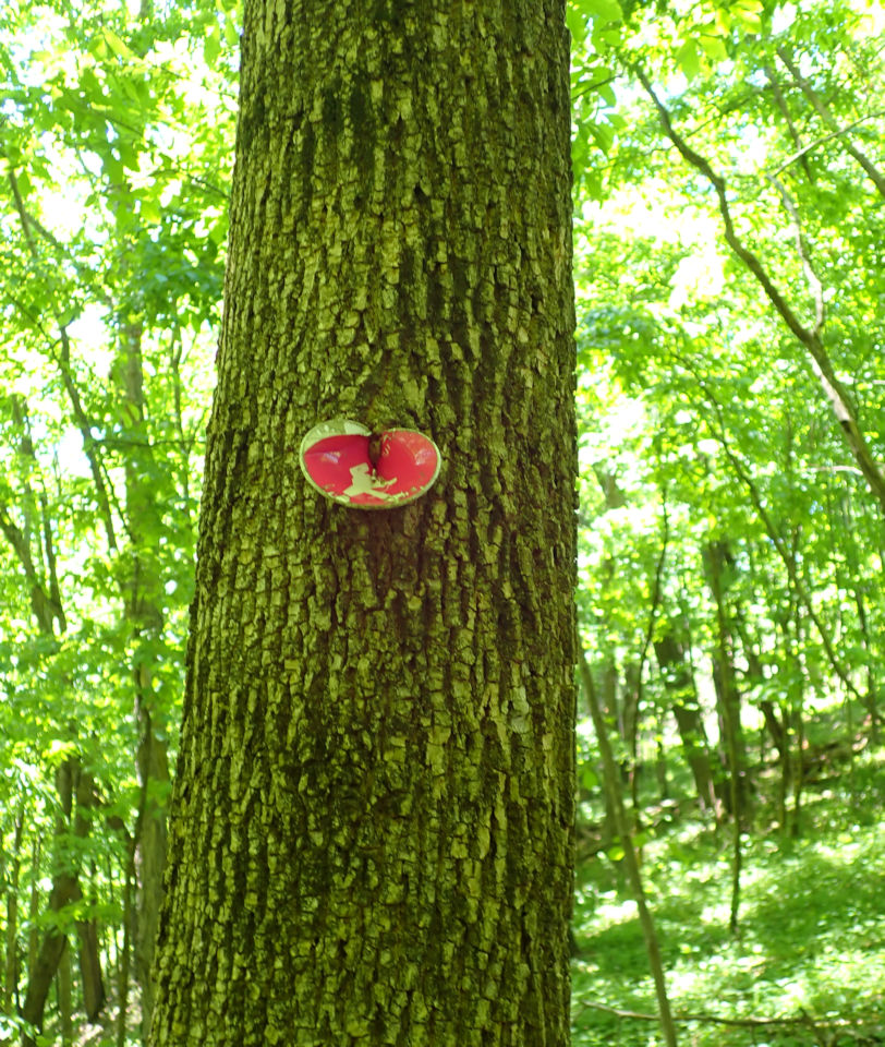
"Holy Crap Charlie, it looks like this poor hiker has seen better times! I wonder if they went in the wrong direction also?"
I'm always amused at the trail markers and if they are beat up, I imagine there is a story to it. This hiker looked as if it was on its last legs. I hope the hiker survived.
See the trail?


It suddenly got more interesting.
Is this confusing or what?

I followed the faint footpath that dead ended on a rock outcrop.
I made a mental note to come back when the leaves had dropped so I could see the incredible landscape that was around me.
There was no trail that I could find coming off the rock so I back tracked past the trail sign and couldn't find even a whisper of a trail.
Charlie and I sat on a log and shared an apple while I thought about things. I could hear the highway to the west and just below me. I wasn't lost at all. But I was frustrated at not finding a very well marked trail. No one had cleared the huge oaks that had crashed down over the trail either. In places I'd had to brush bust through wood nettles to get back on trail.
What to do.
Simple.
Years ago mules and horses came through here to the rock look out. Knowing the folks that I rode with, there would be a trail near the bottom of the rocks.


Charlie was able to follow it easily and seemed to know exactly where he was going. How do dogs do that?
After about 15 minutes of fast walking, we hit the main trail which was an old road. Rich told me that they used to drive their trucks and trailers right up to the top of the ridge and then camp.

Easy peasy. We did it.
The trail description indicates that this trail is a 1 mile lollypop loop.
My MapMyHike app showed that Charlie and I did 2 3/4 miles. I have to admit that we may have missed the so many cool things had we just stuck to the trail in the first place.
We sat in the back of the 'Ru while the interior cooled off. Charlie sat in the shade and gave me this look after I asked him: What did you think of that hike?

In the end. We figured it out and I definitely think this trail would be prettier in the fall and winter. I will have a do-over later this year.
Another fantastic afternoon of exploring and wandering...and not getting lost.