Showing posts with label KVR Trail Challenge. Show all posts

Saturday, May 06, 2023

Tall tails of Trails

Trail Challenge 2023 is coming along nicely. Of course a lot of my hiking is with Charlie or totally solo. 

My buddy Bill is dealing with asthma issues as well as honey-do issues. Olive has Spring Track Meets and she is coaching 5 evenings a week so she pulls double and triple duty, working full time, being a mom and a coach. However, she is enjoying it which truly matters.

I took Charlie with me to do the south end of the Hay Valley Trail which I did last summer. Time Out ~ If you want to review it...

I thought it would be neat to see the same trail in the springtime.

I brought along my infrared camera of course. I can't resist viewing the world in a different light.
These were taken with a 720nm filter.


Bridge 10 with traffic


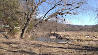
Kickappo River


Kickapoo Backwaters


The North end of Hay Valley offers some neat places to note. One of the harder places to cross is what I dubbed 'The Swamp'. Last year it was wet, mucky, but doable by walking on logs and clumps of grass. It was rather shaded when I did it, but still noteworthy. A walking stick would have been good for some extra balance, but I'm terrible at walking with one. 
I generally set it down and have to go back for it.

Anyway. Spring brought a different view to The Swamp.
It was a bit more wet but more trees had fallen down. Over the years, hikers have place pieces of wood in strategic spots to use while crossing this spot.


All the plants that are in this photo below are Skunk Cabbage plants leafing out. The bright greens of fresh leaves and sunlight were amazing. 


Skunk Cabbage:

The next attraction was the Twin Caves. I don't know if anyone else makes up the names like I do, but it helps me remember exactly where these neat spots are.
I'd seen a hint of a rock shelter when I went through here last year. I wanted to see it in the spring before the undergrowth hid everything.
I was not disappointed as I found a trail that went right between them.


Each 'cave' or rock shelter was at least 6 or more feet tall inside. I didn't have time to hike down into them. I'll have to do that at another time. Perhaps in the winter when the water flows over the rock and forms ice walls.


The forest floor was littered with Virginia Pinks blazing away. We walked the trail rather slowly. I wanted to look at it all.


Most of the trail is part of the original trail system that existed before Kickapoo Valley Reserve took over from the Core of Engineers. Some of the trail has been re-routed to stay out of the steep gorges.


I don't find that trail extremely difficult, but this can be a long hike if you have to go back to where you started from. It was just under 5 miles when I hiked along Highway 131 to get back to where I parked.

Otherwise the distance from bridge 10 and Hay Valley to Bailout Trail is only a bit over 3.5 miles.

It took Charlie and I 2 hours and 40 minutes which included stopping often to look at things which included a trailside chat with a couple of older folks that were out hiking.

The next time I visit this trail, it may be during the fall or winter. Then I can say I've seen it in every season.


Sections 38 and 39 have been knocked off....


Friday, April 28, 2023

The 9 - 10 Trail Deep Dive.


Okay, there was no diving at all. Just some more in depth exploring at one of the spots that interested me last year when Bill and I hiked this short trail.

I wanted to go and see if the field of Bluebells was blooming yet. I found them last year.


Hepatica


They were up and there were hundreds of them in several patches, but the blossoms were still closed tightly. Last year they were in full bloom by May 14th. [I checked when I got home.]

I was slightly disappointed, but took the opportunity to follow a faint trail along the river. 


I wanted to see some places I didn't have time to explore last year. The beauty of doing the trail challenge is to see all the trails and then go back and admire the parts you like best.
Since the flowers weren't showing off, I decided to enjoy the river and its bluffs in that area.

I like this bluff, it is typical of the bluffs along the river but this one is easily assessable by a deer trail in the spring and fall. One has to dodge the spikes of prickly ash, but it isn't a hard hike.

I had to take photos of it in color and in Infrared B&W because it is so stunning.
The IR B&W reads anything green or with chlorophyll as white. The rocks and water remain dark as they are not reflecting the IR spectrum back to the camera.


I made my way to the top of the bluff and enjoyed the view.


I decided to follow another steep trail off the bluff and head down into the lowlands. If I skirted the marshy area, I could stay close to the bluff and stay dry.

Below the bluff on the other side:
Video 12 seconds ~

The marshy area behind me:
25 seconds with peepers!
If you hear a tiny bell, that is Charlie who wears a cat bell with his tags.


The marshy area was chock full of Bluebell plants and Skunk Cabbage sprouting up everywhere. In the distance the geese were raising their voices. 

The other side of the bluff in color and then in IR:


Charlie and I spent most of our time exploring this spot. 


We then headed back up on the trail and finished it off.

On our way back to the parking area, we stopped and skirted another low land marshy area.

Back at Landing 10, we stopped and sat on the canoe ramp for a bit relishing the river noises.

Along the Kickapoo in IR 665nm.


And
that was
the end of our little/big adventure.


Sunday, April 09, 2023

Going Up!


 Map My Hike says this hike had 435 feet of elevation in it. Hmmm. 

I'm not sure how these apps that follow you figure that out. But I do know that from where I parked to the top of the narrow back ridge was a climb of 300 feet. That is according to the topo map from KVR. 
I didn't do a 'close up' of the map because I wanted those read the drivel I write to see what the terrain is like where I walk.

This is the terrain of the 'driftless' region of Wisconsin. The bumps are hills, the shaded parts are slopes. The terrain map helps visualize what it is like where I live. Nothing is level, it is up or down!

The trail is pretty straightforward to the top. 


It is either an old logging road or farm road, it leads to an open area that has been logged and left. Briers and Prickly Ash grow so thick in its place that I doubt anyone or anything would want to walk the open area.


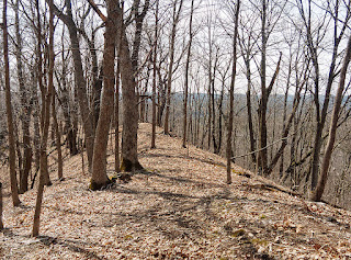
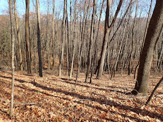
The trail goes around this mess and stays on the sides of the ridge in a mostly old oak forest. Finding the trail in the summer is nearly impossible as Charlie and I found out last year.

We found the top of the ridge easily.


We walked out to the point to see if there was much of a view.

I could look south and see Highway 131 ...


and look north and see the Highway leading to Rockton.


In the summer these limited views are impossible. But, I satisfied my curiosity and decided to finish the trail.


Some places were well marked, and others markers were a spot of yellow ribbon tied to a branch or a tree.

There is no chance of really getting lost as long as you have looked at the map and know to travel around the top of the oddly shaped ridge.
There is a steep drop off  if you do get off the ridge.


It doesn't seem at first that Jug Creek has a lot to offer in the wow factor. However, the old oak stands and maple woods provide a lot of shade and it is nice and cool on a hot summer day on the narrow ridge.
In the spring the forest floor will be covered in Spring Beauties and Pinks.

According to the pamphlet that is available at the Visitors Center, this trail is still under reconstruction. Clearing sections of this trail is not going to be an easy task.

I'd actually like to come back in the winter and snowshoe around the ridge.

Section 44 done.

Monday, March 20, 2023

Motivation

Sunday was cold and windy. I had so much to get done in the morning which included electric fence repairs. 

My Grand Plan was to head out early to the Reserve and see if I could spot red wing black birds and maybe check out the ponds to see if any geese or swans had arrived.

All that went ka-put. After lunch I had to call my elder friend in Alabama. She was having a bad day so we talked for an hour. She is in her mid 80's and was telling me that she had not gone out to do anything in weeks. She forgets to eat, she is isolated she says, and depressed. She used to be a librarian, so I asked her where the nearest library was. Her answer was 3 blocks. I asked her if she'd go to the library and just go find a book and sit at a table and read. 
Why? She asked me. I told her...so she could be around other humans. 

I asked her to visit her meal site once this week and text me what she had to eat. I gave her two assignments or as I called them: Challenges for Motivation. 

I had to agree to let her set a Challenge for me too. She wanted me to send her a photo of me in Mobility Class. 

So today I was at CF and did Mobility Class afterwards. My coach Angie took these photos for me.
Mobility Class:

Shoulder Rotations

After class. 
One of my little pals, 
coach's daughter.


Am I going to be successful in helping someone a long distance away get Motivated? I sure don't know, but I like my Alabama friend. It is unfortunate that she has no immediate relatives to help her look out for herself. She is also fiercely independent so it is hard for her to ask for help.
This is the woman who was Captain of an Oil Rig in the Gulf when she was in her 30's. Mind you, that was over 50 years ago!

So. After my motivational talk. I packed my camera bag and headed out the door in the late afternoon to get myself moving.
I knocked off another section of the KVR Trail Challenge and enjoyed fresh cold air. I took what I think is a boring trail. It was so far from boring!

I will let these photos speak for themselves. This is along what is called the Old Harrison Trail. It leaves the Visitor Center and heads down towards the valley. It was a road once upon a time. On one side, it is marshy and wet, on the other side there are rocks and trees.
The huge surprise was the icicles on the rocks.

With the recent alternating snows and rains water has been seeping from the rocks around pines clinging to the rocks...


I found two pairs of Canada Geese:


I saw red dogwood, the pussy willows are starting to blossom, and there were some other trees budding that I couldn't ID.


I even took a photo of myself next to the Kickapoo River and sent it to my friend to make her day a little happier?


I do wonder how I can help my friend and motivate her to go to the meal site and interact with others. 

I know motivation has to come from within and cannot be forced. 

Sigh.

I am a curious person who likes to explore and be social too. I cannot imagine losing something so precious as motivation. It would crush my life.


Tuesday, December 13, 2022

Rain and Wind and...other stuff.

Well, looks like some nasty weather is heading this way this afternoon. 

Looks like it will be time to batten things down. 


I made a snowman on Friday during the snowstorm. I haven't done one in such a long time I figured I'd forgotten how. 
I didn't.

And truthfully, it was one of the ugliest snowmen I've ever made. I took a breather from shoveling out a walkway to the shed to roll snow. This is what I got. He or she looks mad because I used mulch chips for the eyes and the nose...that kept falling out. 

Maybe it was mad because the birds kept landing on its arms or the mules would come up and stare at t and laugh.


I don't think I'm very good at building snow people. The next morning....


It appeared as if someone had murder-ized it. 

Upon closer investigation....


The culprit was revealed...I think!

With the temps hovering just above freezing, everything is melting and getting sloppy. I imagine with all the rain we are getting it will be muddy too. 


I finished this project and received the finished book from Blurb. It turned out really nice. 


I think with all this crazy wicked weather, I may just start on my next project which I think will be about the Trail Challenge I did this past year with Charlie. I have so much information and photos to sort through, it will be a challenge in itself.

I started on January 8th with two friends and two dogs. I finished in November on a dreary day. I mulled over the thought of doing the challenge again this year. Now that I know the trails, perhaps I can plan the hikes better.

The photo that inspires me to actually get this done is a photo taken by fellow blogger Aurora

This amazing shot she took of the two of us in October should be the cover, don't you think?


In so many ways this photo says it all. Such a tiny dog and her minion ... blazing trails together!

There is something so calming about walking or hiking through the forest.

However, most of this week will be dealing with the nasty weather heading across the US.


Monday, October 31, 2022

Section 30 County P ~ KVR Trail Challenge


Recall that little blind? It is so tiny, even a little person like myself can barely move in it. 

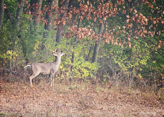
However it is proving to be pretty fun on some mornings. This little 8 point buck was about 300 yards away at the other end of the meadow.

This little doe came from the neighbor's meadow and walked between the fence wires. 


She kept looking around and the buck at the other end of our meadow saw/smelled her. He walked towards me and she ducked into the woods just west of this shot.

That was all the action I saw on Friday morning.

Charlie and I loaded up and headed out to tackle the trail section I'd been avoiding at Kickapoo Valley Reserve. 


Charlie and I saw some traffic and a lot of pheasant hunters. Charlie got his fill of hearing shotguns go off near the Weister Creek Trail. He became a bit nervous but didn't freak out. 

In my opinion there is no benefit to having the side of the road be designated as a Trail to hike on. 


The Trail Section is #30. It runs from Pott's Corners to KV Ranch which used to have horses years ago and would take folks on trail rides.  A person could stay at the cabin and ride down the road to access the rest of the KVR Trails.
Part of the access was a gate that led to a short section of the West Ridge Trail that still exists but is poorly maintained. We found the marker on our way back from the end near the KV Ranch. 

It was hidden and had not obviously been used, yet is part of the Trail Challenge.

Once we brush busted through the berry briars we did end up on what used to be a nicely groomed steep uphill climb. When I got to the top of the hogback ridge, the trail disappeared off to the right somewhere. There was no evidence of it being used recently at all. 

We spent time searching and found pieces of the trail. There were no markers, however if one studied the leaves and the ground you could sort of figure out where it was supposed to be.

It was however, very pretty.


We followed the trail and ducked under branches and went around deadfalls until we came out on Strait Rd at County P.


The mileage for this one way was 1.87. We may have done more as we wandered here and there to scout out the trail.

We found an area in the West Ridge Trail [woods] that was loaded with Wild Ginger and Hepatica. I noted that it would be neat to see the abundance of wildflowers next spring.

We made it back to where we parked with no issues. The traffic wasn't too bad on the road, but still it kept me wondering why it was marked as a trail. 


I have one other trail just like this to knock off this week and it is a bit longer. It runs from County F near the Wildcat Mountain border, follows State Hwy 131 for a bit and then heads out Hay Valley Rd to Campsite U and the Hay Valley Trail Head. 
At least part of this trail has a beaten down trail in the grass off of the road on County F.

Having a partner for these trails would be really nice. As it is I am doing them solo with Charlie so we walk the 'trail' and turn around and walk back.
With Bill we'd park one vehicle at each end and walk point to point.

I'm still close to our goal though.

With all the backtracking Charlie and I have done, I figured we've done about 70 miles of hiking or more at the KVR. All of it has been an adventure.

Charlie has been a champ. I think it proves that little short/long dogs can do it too. There have been a few times when I've had to carry him in warmer weather, but mostly he is an avid hiker.

Our goal is within reach and I hope to have it finished off before the gun deer season begins.  I have 4 more planned hikes. Three of them will require me to again go over trails I have done to trails I haven't done and then return.

I'm okay with that as it allows me to see the same woods in different seasons.

Here is Charlie in his home made carseat waiting for a treat and a ride home.


I thought I'd regret not getting another terrier, but he has proven to be an excellent partner in hiking as well as cuddling.

And...we are off again hopefully today!