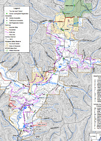
More about KVR here: Kickapoo Valley Reserve
There are links to the Reserve site and activities that go on there. There is a long and storied history about how the Reserve came to be including the Dam Project as the locals call it or the Flood Project that was going to make a huge lake and keep the towns along the Kickapoo from flooding.
I'm not going to write about that. It is a bitter story, but a very interesting one.
The Reserve or KVR as we now call it is located in the Driftless Region of Wisconsin.
They have something called the Trail Challenge. If you complete all the items on the list in one year and turn in the paperwork, you win a free pass to the KVR for the next year.
I'm not interested so much in the 'free' pass, but in the challenge itself.
I need a self challenge. Something to have as a goal. This looked like a good one.
So Friday I took the first steps.
Doing the challenge takes some pre-planning especially if you are by yourself. I can see that in order to do some of the trails it would be handy to be 'dropped' off at one area and picked up at the other end.
My first hike was on known trails that looped back to the Visitor Center.
For this 'project' I have acquired a little pal.
He is a finger puppet and I have a fondness for skunks anyway. He is small enough to fit easily in my pocket.
Why not?
I followed the Dam Trail to the Dam Tower.
Down the stairs...
Along the Old 131 Trail which is a groomed cross country ski trail in the winter. Hikers and snowshoers need to keep off the groomed trail.
Trail that leads alongside the dam to the Tower.
The Tower.
I wanted the photo of the tower to mimic the old files photos from the 1970's when the project was underway.
View of the river. See that rock bluff? That was part of the next segment I was going to do, it is straight across the Kickapoo River.
I can never get enough views of the rock formations along this river.
After finishing off the Dam Trail, I headed back past the Visitor Center and launched into the Wintergreen Bluff Trail.
I've done this trail twice before. So I was pretty sure I had allotted enough time to get it done.
Remember that bluff from the Dam Trail?
Here is a slightly poor panoramic shot of the view from atop that bluff.
This is an amazing trail in any season.
The photos below are towards the end of this trail which really does just end at a bluff.
There are a few spots on this trail that require paying close attention to footing.
The rock stairs can get slippery when wet, snowy, or icy.
You can circumvent these stairs and take a high path near the highway.
I generally chose to take the more difficult path, of course. But it can lead to more adventures.
Such as the ice flow over the trail.
It was easy to get around and the colors in the ice were amazing.
If I'd had no place to be, I could have spent hours along this trail. As it was, I'd told my husband I'd be home somewhere around 2 pm.
What can I say? Doing the Trail Challenge will be a challenge! My oldest son would wonder if I could actually hike and not stop all of the time to take photos.
I don't know. We will see.
I did use a cell phone app called Map My Hike.
It helped me move along by telling me how long each mile I did took and what my pace was.
The chart on the bottom explains your pace ~ blue line. And the red line is a chart of the elevation changes made during the hike.
I won't lie.
Hiking the Kickapoo Reserve is going to be tough. The only real flat trail is the Old 131 Trail which is the old 131 highway. Everything else will be very demanding.
Just up my alley!
My Stinky Skunk friend and I made it. I smiled all of the way home and then got out the map and plotted my next trail adventure.
Only 47+ miles to go!


No comments:
Post a Comment
Please include at least your first name if you are commenting Anonymously. Thank you.